High-Accuracy Aerial Surveying & Mapping
Aeronics Consultoria Pvt Ltd delivers DGCA-compliant drone survey and mapping services for land measurement, infrastructure planning, construction monitoring, and GIS data generation.
Our drone-based approach significantly reduces time, cost, and human error compared to traditional surveying methods.
- Centimeter-level accuracy using RTK/PPK workflows
- Rapid data acquisition across large areas
- High-resolution orthomosaic & elevation models
- 3D, contour, and volumetric analysis

What is Survey & Mapping?
Survey & Mapping is the process of collecting precise spatial data to measure, analyze, and visualize land, terrain, and physical features of an area. Using drone-based aerial surveys combined with advanced photogrammetry and GIS technologies, accurate maps and 3D models are generated for planning, analysis, and decision-making.
Technology Used
Drone-Based Aerial Imaging
High-resolution RGB cameras mounted on drones capture detailed aerial imagery for accurate mapping, orthomosaics, and visual analysis.
RTK / PPK GNSS Positioning
Real-Time Kinematic (RTK) and Post-Processed Kinematic (PPK) GPS systems ensure centimeter-level positional accuracy without extensive ground control points.
Photogrammetry Software
Advanced photogrammetry converts overlapping drone images into orthomosaic maps, 3D point clouds, digital surface models (DSM), and elevation data.
LiDAR Technology
Light Detection and Ranging (LiDAR) sensors generate highly accurate 3D terrain models, even through vegetation and complex landscapes.
Ground Control Points (GCPs)
Precisely surveyed reference points improve mapping accuracy and ensure compliance with survey-grade standards.
GIS & Spatial Analytics
Geographic Information Systems (GIS) enable spatial analysis, data layering, measurements, and integration with cadastral and planning datasets.
3D Modeling & CAD Tools
Survey data is converted into 3D terrain models, contour maps, and CAD-ready outputs for engineering, construction, and planning workflows.
Cloud Processing & Data Delivery
Secure cloud platforms process large datasets efficiently and provide easy access to maps, reports, and downloadable survey outputs.
How Our Survey Process Works
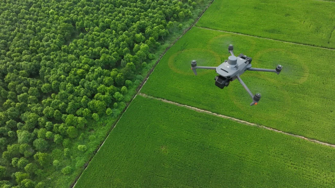
Site Assessment & Requirement Analysis
We begin by understanding project objectives, survey boundaries, required accuracy, and expected deliverables. Terrain conditions, accessibility, airspace classification, and DGCA permissions are carefully reviewed. This ensures the survey is compliant, safe, and aligned with client goals.
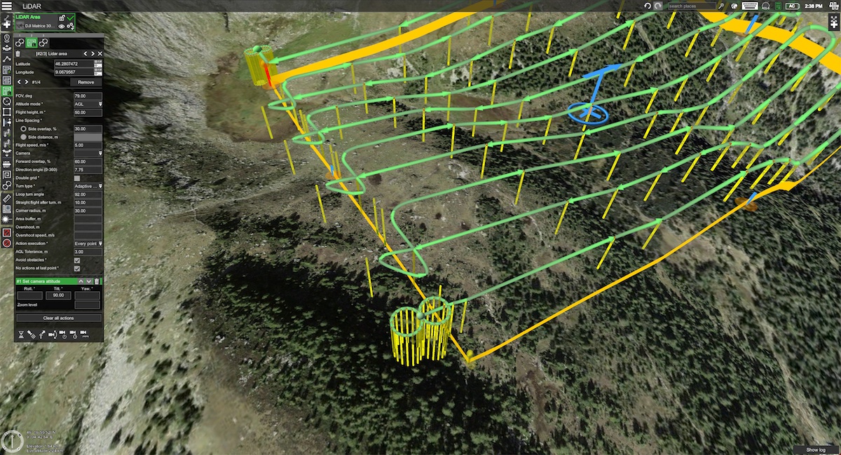
Flight Planning & Mission Setup
Using professional flight-planning software, we design optimized mission paths. Parameters such as altitude, frontlap/sidelap, camera angle, and RTK/PPK settings are configured to achieve consistent data quality and maximum positional accuracy.

High-Resolution Drone Data Capture
Our DGCA-certified pilots execute the mission using calibrated drones equipped with high-resolution sensors. Images are captured with precise overlap and geotagging, ensuring reliable photogrammetric reconstruction even over complex terrain.
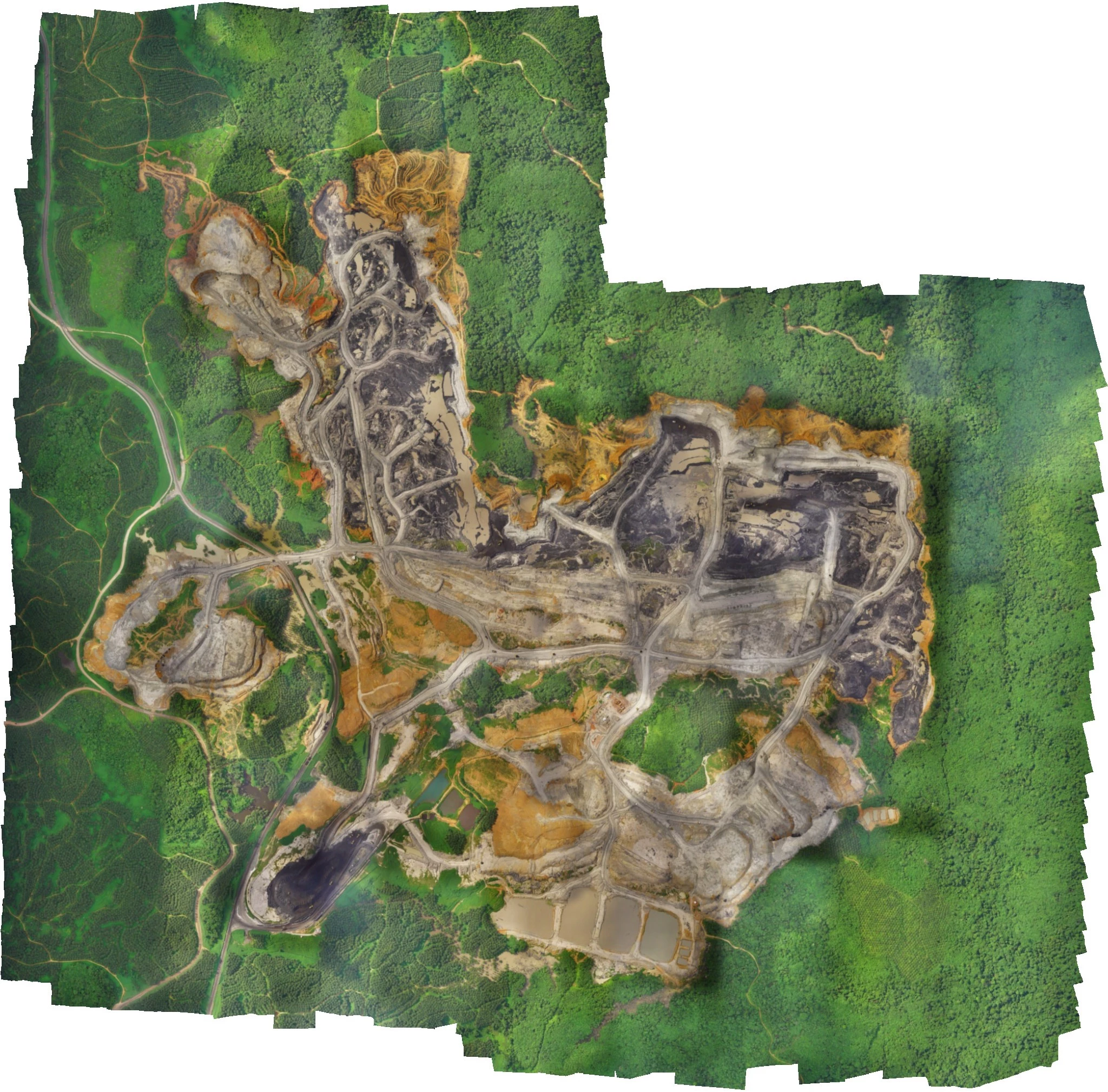
Data Processing & Photogrammetry
Captured imagery is processed using advanced photogrammetry and GIS software. Outputs include orthomosaic maps, DSM/DTM, contour maps, point clouds, and 3D models, all generated with strict quality control checks.
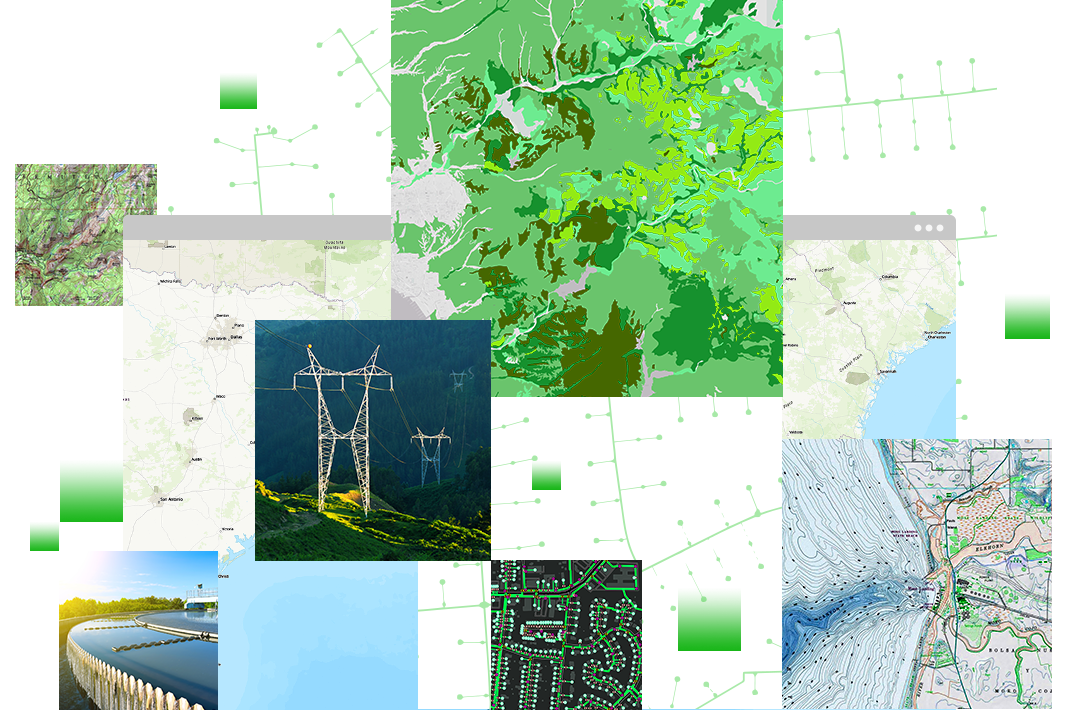
Analysis, Validation & Final Delivery
Final datasets undergo accuracy validation against ground control points. We deliver GIS-ready data, CAD drawings, analytical reports, and actionable insights tailored to planning, construction, and decision-making workflows.
Benefits
High Accuracy & Precision
Achieve survey-grade accuracy with RTK/PPK GNSS, LiDAR, and photogrammetry—ideal for engineering, land records, and infrastructure planning.
Faster Data Collection
Large areas can be surveyed in hours instead of days, significantly reducing project timelines and accelerating decision-making.
Cost-Effective Surveys
Minimize manpower, equipment, and field time compared to traditional ground surveys while maintaining high data quality.
Improved Safety
Eliminate the need for surveyors to access hazardous or hard-to-reach areas such as mines, highways, steep terrain, and construction zones.
Comprehensive Visual Insights
High-resolution orthomosaics, 3D models, and contour maps provide clear visual understanding of terrain and site conditions.
Better Planning & Decision-Making
Accurate spatial data supports informed decisions for design, construction, land management, and regulatory compliance.
Repeatable & Scalable Surveys
Easily repeat surveys over time to track progress, changes, volume calculations, and site development.
Easy Integration with Engineering Tools
Survey outputs are compatible with GIS, CAD, BIM, and enterprise systems for seamless workflow integration.
Environmentally Friendly
Drone surveys reduce ground disturbance and environmental impact compared to traditional survey methods.
Need Accurate Survey & Mapping?
Partner with Aeronics Consultoria for fast, reliable, and DGCA-compliant drone survey solutions.
Get in Touch